This is a translated summary of the original article published by the Humanitarian OpenStreetMap Team (HOT). For the full, original article in Spanish, please visit: Implementación de Mapeo Abierto en la Gestión Municipal: Proyecto de Mapeo Colaborativo de Transporte Público en Zamora
The Rutatón-Zamora project in Mexico is a groundbreaking collaborative mapping initiative aimed at transforming public transportation systems in the city of Zamora, Mexico. Trufi Association is part of this effort, led by the Municipality of Zamora’s Department of Mobility, in partnership with Codeando México, CoMapper, and supported by the Humanitarian OpenStreetMap Team (HOT). The goal is to accurately map public transportation routes to improve access, efficiency, and overall mobility in the region.

The Power of Collaborative Mapping
Before this project, there was no comprehensive map available for the region’s public transport routes, making it difficult for the municipality to plan and optimize services.
The collaborative effort included the use of OpenStreetMap (OSM) tools and technology such as OSMTracker and Mapillary. The team was able to gather accurate data on routes, stops, and the number of active transport vehicles. Trufi contributed our expertise in mobility and mapping, helping to ensure that the data collected could be effectively used to build a comprehensive and practical transport map.
This data has now enabled the Municipality of Zamora to take a significant step forward in understanding the dynamics of its public transport system and making informed decisions for future developments.
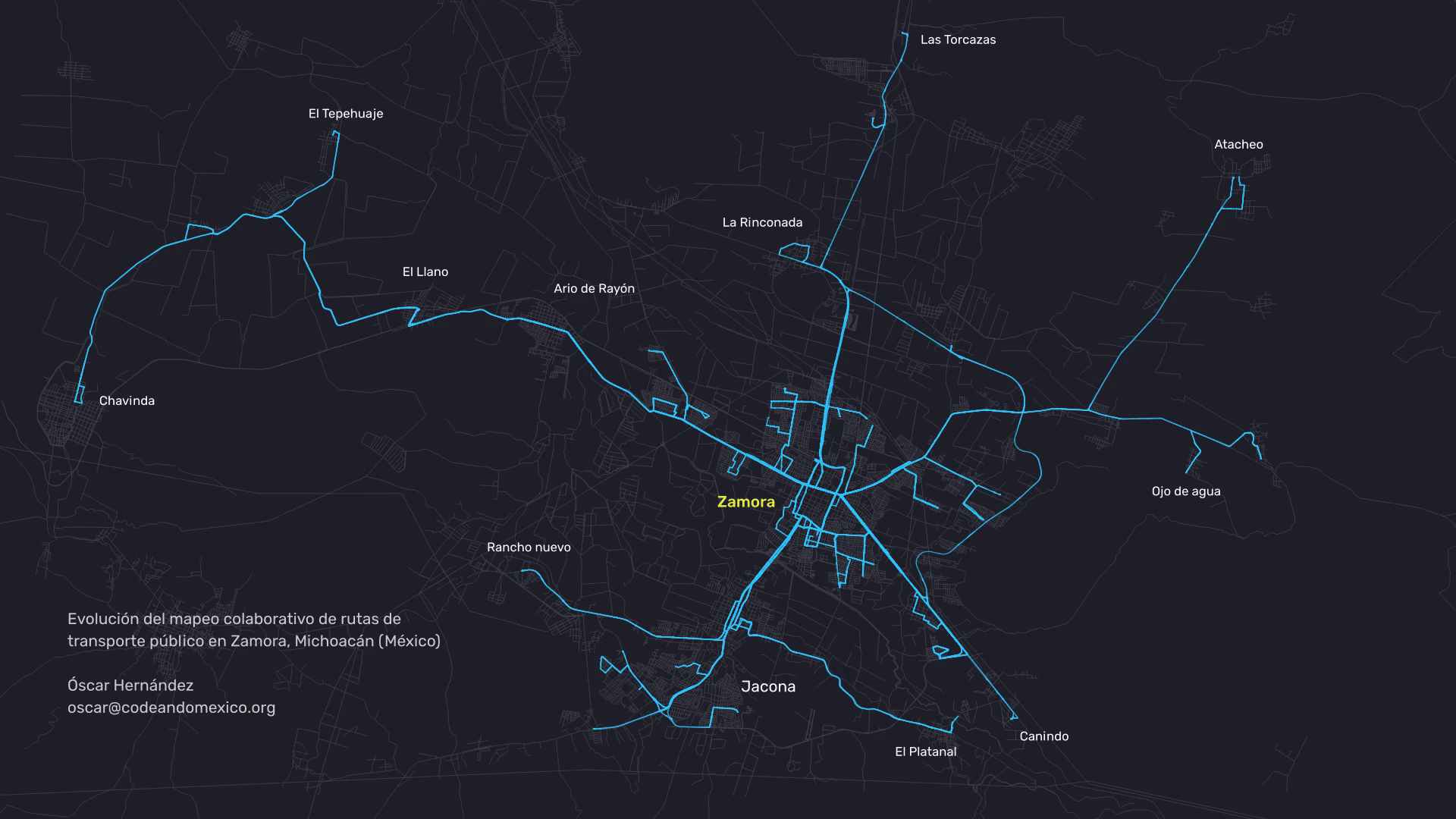
Image: Oscar Hernández, Codeando Mexico
Daniel Acevedo, from the Municipality’s Department of Mobility, said they had “a vague idea” of how the transport network operated, based on what operators told the department. “But we didn’t know for sure how the system really worked. This project gave us the evidence we needed about public transportation.”
It became clear that many assumptions about the transport network were inaccurate. For example: Officials estimated that 12 routes were operating in the region. The project revealed that only 11 were active, with eight of them shared with the neighboring municipality of Jacona. Similarly, the project revealed an accurate count of the fleet — from an expected 390 vehicles, only 330 were found to be operational.
A New Era of Mobility in Zamora
Trufi’s participation in the Rutatón-Zamora project reflects our commitment to using open data and community-driven efforts to improve transportation systems around the world. The results of this initiative will be integrated into Zamora’s future Plan Integral de Movilidad Urbana Sostenible (PIMUS), ensuring that public transportation remains a core element of the city’s development. As we continue to support such projects, we look forward to seeing how this new, comprehensive transport map will positively impact the lives of residents and visitors alike.
Pingback: weeklyOSM 740 – weekly – semanario – hebdo – 週刊 – týdeník – Wochennotiz – 주간 – tygodnik